
The Canal du Midi from Revel: history, figures and sights within an hour
The Canal du Midi does not pass through Revel, but its water does: it comes down from the Montagne Noire through Lake Saint-Ferréol and the Rigole de la Plaine to the Naurouze watershed, 30 minutes from the loft. This page sums up the canal's history and figures from official sources, then lists what you can see of it within an hour's drive, how to cycle along it, and whether it is open to boats today.
The story in brief
Plans for a canal between the Atlantic and the Mediterranean are old; all of them failed on the high point at Naurouze, which must be fed with water. Pierre-Paul Riquet proposed bringing it from the Montagne Noire, won over Colbert, and in October 1666 Louis XIV signed the edict for the Canal royal du Languedoc. Work began in 1667 at Toulouse and in the Montagne Noire; boats reached Castelnaudary in 1674; in 1681, fourteen years on, twenty-five barges made the inaugural voyage from Toulouse to Sète. Riquet had died the year before. After Vauban's inspection in 1686, the aqueducts were built from 1687 to 1694 and the Saint-Ferréol dam raised.
The man, his trade, his money and what he lived to see are on his own page. The dam and the channel that bring the water have theirs too.
The figures, depending on what you count
The Canal du Midi itself runs 240 kilometres from Toulouse to the Thau lagoon at Marseillan and has 63 locks: 45 single, 12 double, 4 triple, one quadruple (Saint-Roch at Castelnaudary, a 9.43 m drop) and one eightfold staircase (Fonseranes at Béziers, now six chambers). These are the figures of the Occitanie tourist board, Lauragais Tourisme and the Castelnaudary tourist office.
The UNESCO property is wider: the canal, its feeder system in the Montagne Noire and its 18th-century extensions (Canal de Brienne, Canal de Jonction and Canal de la Robine), 360 kilometres of canals and channels in all. On that perimeter the DRAC Occitanie counts 328 structures (locks, aqueducts, bridges, tunnels), while the tourist board's 2025 documentation speaks of "more than 300 structures: 78 locks, over 50 aqueducts, spillways, tunnels, bridges" across 89 communes. Both counts are official; they simply slice the structures differently.
The water travels 65 kilometres of channels from the Alzeau intake, over 680 metres up in the Montagne Noire, down to Naurouze. The oval locks, Riquet's answer to the pressure of the earth, have become the canal's emblem. Since 1856 the Canal latéral à la Garonne has extended the link to Bordeaux: together they form the Canal des Deux Mers. The canal belongs to the French state and is run by Voies navigables de France (VNF).
World Heritage since 1996
The Canal du Midi has been on UNESCO's World Heritage List since 1996, under cultural criteria (i), (ii), (iv) and (vi) according to the DRAC Occitanie, as one of the most remarkable feats of civil engineering of the modern era. 2026 marks thirty years of listing. UNESCO's own website could not be consulted on the day of our check; these facts come from the Ministry of Culture, the Occitanie tourist board, VNF and the Mérimée database.
The Naurouze watershed: the canal's highest point
At Montferrand, in the Aude, the canal crosses its summit, 189 metres above sea level according to the Occitanie tourist board and the Castelnaudary tourist office (190 metres on other official pages, 194 metres for the pass itself). This is the watershed: on one side the water flows to the Atlantic, on the other to the Mediterranean. You can see the remains of the octagonal basin Riquet had dug to receive the channel's water, ringed by a small channel of its own, an avenue of 200-year-old plane trees, and the 20-metre obelisk raised between 1825 and 1827 by his descendants. Basin, summit reach and obelisk were listed as historic monuments by order of 15 October 1996.
The site is open air, on public land; no official source publishes opening hours or parking. An information kiosk of the Castelnaudary tourist office operates there from June to September. From the loft it is 30 minutes by road, or by bike along the Rigole de la Plaine: the Véloccitanie stage from Naurouze to Revel is 38 kilometres.
Port-Lauragais: the port on the motorway
In the commune of Avignonet-Lauragais, Port-Lauragais is a service area on the A61 motorway built around a canal port, between exits 20 (Villefranche-de-Lauragais) and 21 (Castelnaudary). You can also reach it without the motorway, by the D80 from the village: the Haute-Garonne county council notes that the area is reachable by the D80A and has a free, open-access outdoor car park. It has a hotel-restaurant, a bar, a harbour office and two licence-free houseboat rental bases.
The Espace découverte du Lauragais, opened on 11 July 2022 by the county council and run by Haute-Garonne Tourisme, is free: a lock model under a glass bell for the canal, then the wind, woad and the produce of the Lauragais. A rental company offers electric boats by the hour for 2 to 12 people, and bikes; the harbour office answers on +33 5 62 80 14 88.
Castelnaudary: the Grand Bassin and the Saint-Roch locks
Eighteen minutes from the loft, Castelnaudary is the nearest canal port: the seven-hectare Grand Bassin, the small basin that serves as harbour, and the four-chamber Saint-Roch staircase, dated 1678, with a 9.43 m drop. Boats have reached the town since 1674. A commented boat trip of one or two hours leaves from Saint-Roch, from 9 € per adult according to the Castelnaudary tourist office, checked 29/10/2026, and small electric boats are rented by the hour. Swimming is forbidden along the whole canal.
Lauragais locks: Négra, Gardouch, the Voûtes aqueduct
Between Naurouze and Toulouse the canal runs beside the Deux Mers motorway through lock hamlets. At Négra, in Montesquieu-Lauragais, the mail barge that carried travellers from Toulouse to the Mediterranean made its first stop from 1681 for the midday meal: the inn, stables and a chapel of 1692, one of six on the canal, remain, with a small aqueduct upstream, picnic tables and parking by the lock. At Gardouch, the former Agals port shipped Lauragais grain; its flour mill is now a community space on the quai Riquet. Between Gardouch and Renneville, the Voûtes aqueduct, built from 1688 to 1690 on Vauban's orders, carries the canal over the Hers river on two arches.
Négra lock
Montesquieu-Lauragais · 39 min from the loft
The mail barge's old lunch stop and its chapel.
Toulouse and Ramonville, an hour away
The canal starts at the port de l'Embouchure in Toulouse, where the Canal du Midi, the Canal de Brienne (1.5 km to the Garonne, opened in 1776) and the Canal latéral à la Garonne meet; the Ponts-Jumeaux date from 1776, the third bridge from 1838. The Toulouse tourist office suggests a 12-kilometre waterside walk from the prairie des Filtres, and several companies run boat trips through the locks. In Ramonville-Saint-Agne, Port-Sud rents licence-free electric boats from 1 April to 5 November 2026 according to the Occitanie tourist board, "depending on the canal's navigation season".
By bike, section by section
The canal is followed by the national Canal des 2 Mers cycle route, but the surface changes from one section to the next, according to the route's official stage sheets checked 29/10/2026. Toulouse to Montgiscard, 21 km: asphalt greenway, signposted from the city centre. Montgiscard to Naurouze, 27 km of asphalt greenway beside the motorway. Naurouze to Castelnaudary, 13 km of unimproved towpath on a provisional alignment, mountain bike advised. Lauragais Tourisme reckons, at 15 km/h, 1 h 50 from Toulouse to Ayguesvives, 1 h 35 from Ayguesvives to Naurouze, 55 minutes from Naurouze to Castelnaudary and 2 h 45 from Castelnaudary to Carcassonne.
From the loft without a car: the Rigole de la Plaine greenway from Revel, then the Véloccitanie stage to Naurouze, 38 km in all, where you join the canal. Surface details are on our rigole page.
Is the canal open to boats today?
Yes. The Occitanie tourist board calls it one of the oldest canals in Europe still in use, and VNF counts nearly 10,000 boat passages a year at the Argens lock, with the country's main licence-free hire bases, busiest from July to September. Navigation follows a season, though, and depends on water reserves: on 3 November 2025 VNF closed the locks and banned navigation until further notice because of the exceptional drought in the feeder dams and rivers, a measure already taken in 2023. Check the current season's dates on vnf.fr before hiring a boat; operators announce their openings "depending on the canal's navigation season".
Frequently asked questions
Who built the Canal du Midi?
Pierre-Paul Riquet, salt-tax farmer of Languedoc, appointed contractor by Louis XIV after winning over Colbert; his son Mathias finished the work after his death in 1680.
How long did the Canal du Midi take to build?
Fourteen years between the 1666 edict, the first digging in 1667 and the inaugural voyage of 1681. The last works prescribed by Vauban date from 1694.
How long is the Canal du Midi and how many locks does it have?
240 kilometres and 63 locks from Toulouse to the Thau lagoon. The UNESCO property, which includes the feeder channels and side canals, is 360 kilometres with 328 structures according to the DRAC, 78 locks according to the Occitanie tourist board.
Can you cycle along the Canal du Midi?
Yes. From Toulouse to Naurouze the path is asphalt; from Naurouze to Castelnaudary it is an unimproved towpath where a mountain bike is advised.
Is the Canal du Midi open to boats right now?
It is in service, but the season depends on water reserves: VNF closed navigation on 3 November 2025 because of drought. Check VNF's notices before hiring.
Where can you see the Canal du Midi from Revel?
Castelnaudary in 18 minutes, Port-Lauragais in 29 and the Naurouze watershed in 30 by road from the loft; by bike, along the Rigole de la Plaine to Naurouze.
Sleep next door
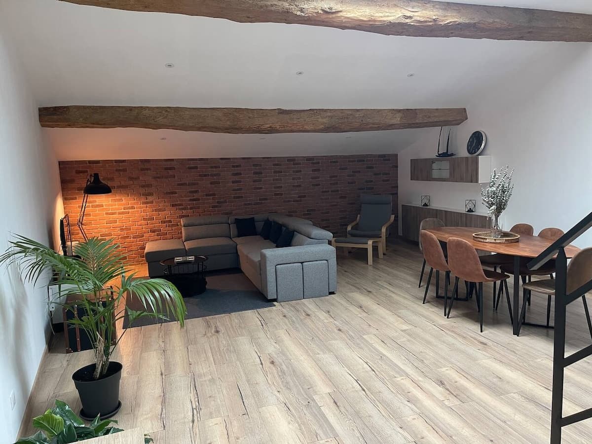
The Industrial Lodge, an 85 m² loft for five in the hamlet of Dreuilhe. Booked direct, 10% less than on the platforms.
€63a nightwhen booking here€70 on the platforms
See also
Your host: Florian